
As some of you may have noticed, NOAA NGS released GEOID18 recently. I wanted to let you know that the new model is available in the Digital Coast Data Access Viewer (DAV; locally pronounced Dave). Not only is it available, but it’s the default NGS geoid model for data that starts from point clouds. We’re going to review a little of what this might mean to you.
First, the switch of defaults means that if you recently downloaded orthometric data (before November 19, 2019), it’s almost certainly not using GEOID18. If you download more data to compare, you’ll want to either make sure you match geoid models under the advanced options, or re-request the previous data.

Note that this is only point clouds. Things that are already raster DEMs haven’t been set up to change models and are often lacking adequate documentation regarding which model was originally used. Maybe someday. This does mean that using the DAV to make a DEM from the point cloud and getting the same area from a pre-made DEM may give different results because of that geoid model difference.
So, how different are the two most recent models, GEOID18 and GEOID12b. Lucky for us, NGS made a nice graphic of exactly that, which I’m including here, but they have have a whole page showing model comparisons.
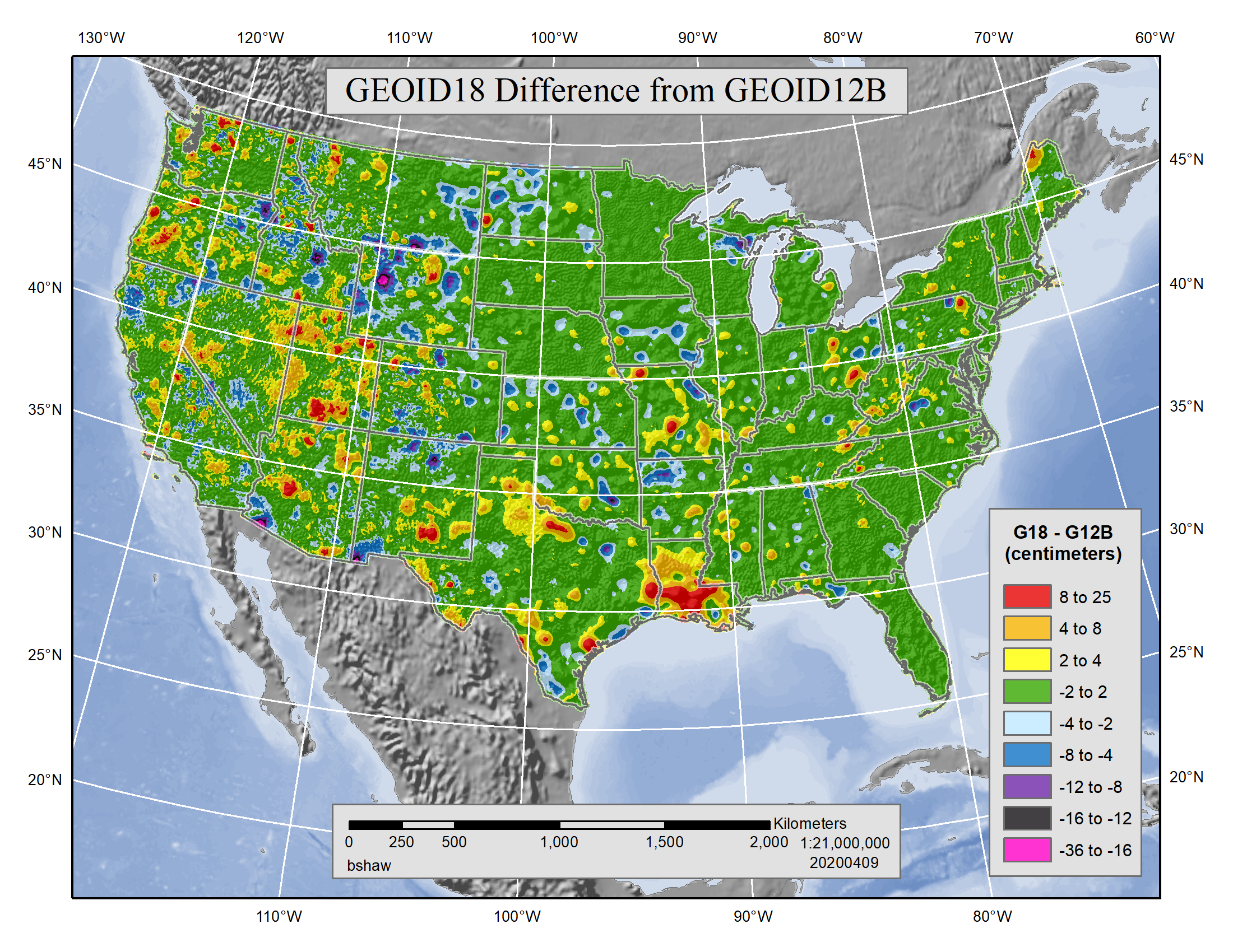
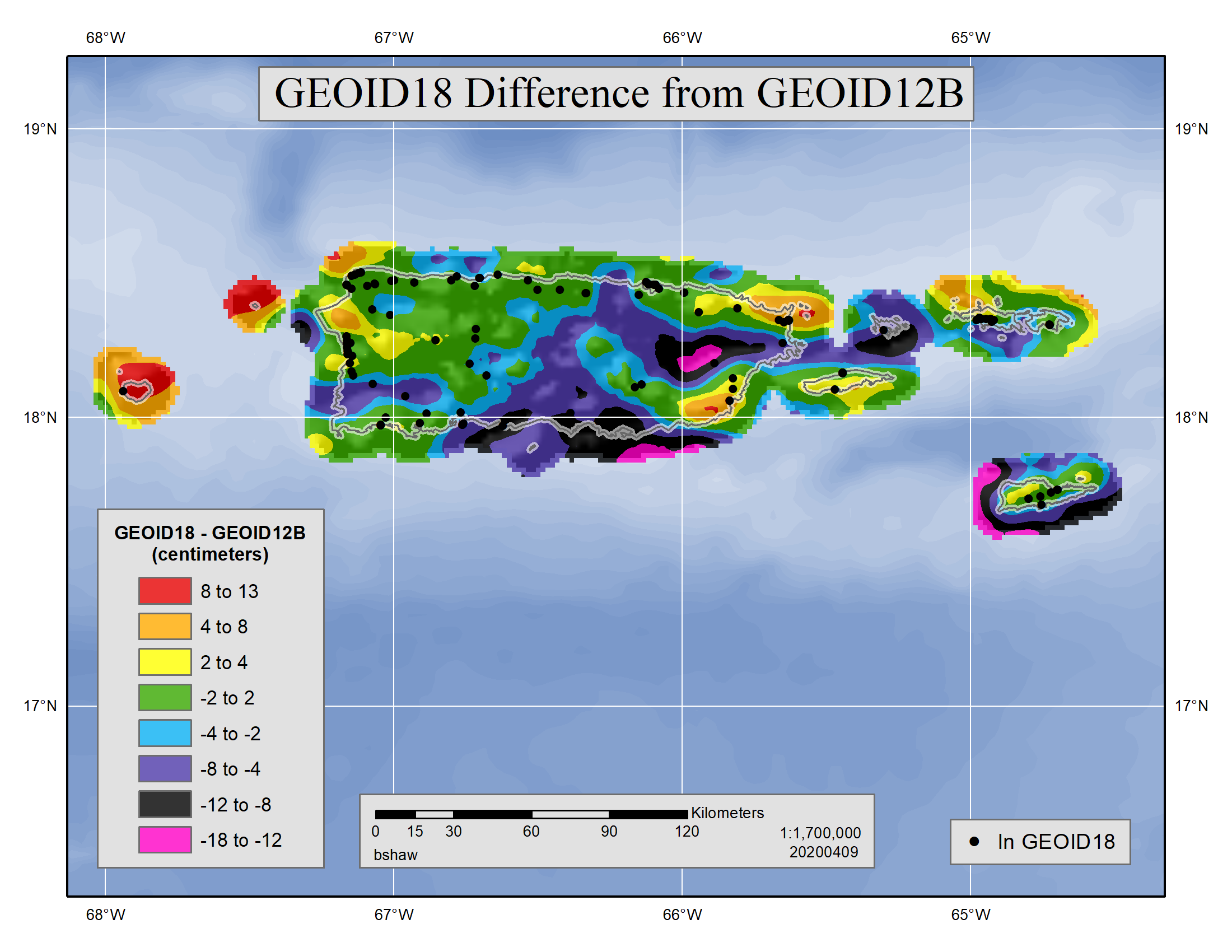
As you can see, some of those differences from GEOID12B are pretty big, at least in the context of lidar data. Some are certainly greater than the RMSE of a typical recent lidar data set.
You probably noticed that I only put up the comparisons for CONUS and the Puerto Rico area. That’s because GEOID18 doesn’t cover the rest of the country. The rest are still on GEOID12B and I expect won’t be updated until the new reference frames are rolled out in 2022. If you request data in those areas, the system will use GEOID12B even if you specify GEOID18. There should be a note in your email for pickup and it will be in your metadata.
If you find the documentation on the geoid that was used is missing, please let us know so we can fix it. The same email address that sent you notifications can be used to contact the DAV team.
Update: Some of the originally released GEOID18 grids had a problem and an update was released for those grids on December 9, 2019. They were incorporated into the DAV the same day.
