NOAA Logo

Digital Coast GeoZone

Tech talk for the Digital Coast

Menu Skip to content
  • Home
  • About
  • Digital Coast
    • Data
    • Tools
    • Training
    • Stories
    • Topics

Tag: poetry

February 13, 2013July 1, 2016Nate Herold

Valentine’s Day Poetry

December 20, 2012July 1, 2016Nate Herold

The Twelve Days of (Geospatial) Christmas

Image of mangroves showing high tide and low tide marks.
January 18, 2012July 1, 2016Geoscience Consultants
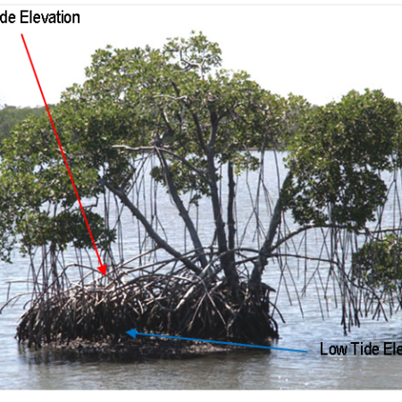
Sail at Low Tide?

Categories

  • Economics
  • Elevation
  • General
  • Imagery
  • Land Cover
  • Marine Cadastre
  • Sea Level Rise
  • Water Quality

RSS Feed RSS - Posts

Tags

accuracy acoustics ArcGIS beach canvis cartography change Charleston Christmas climate change coastal and marine spatial planning Coastal Change Analysis Program (C-CAP) coastal economy coastal flooding coastal geotools coastal mapping contours data data access datum DAV DEM economy elevation ellipsoid enow Esri flood GDP geeks geoid GeoTiff GIS Green Infrastructure habitat hurricane Hurricane Sandy Imagery indicator inundation jobs land cover data Landsat Landsat Data Continuity Mission land use LAS LAZ lidar map comparison mapping maps map services metadata minimum mapping unit National Climate Assessment ocean uses organization orthometric planning poetry raster remote sensing requirements resolution return on investment Sea Level Rise spatial standard statistics tides TIFF tools USGS vector water quality